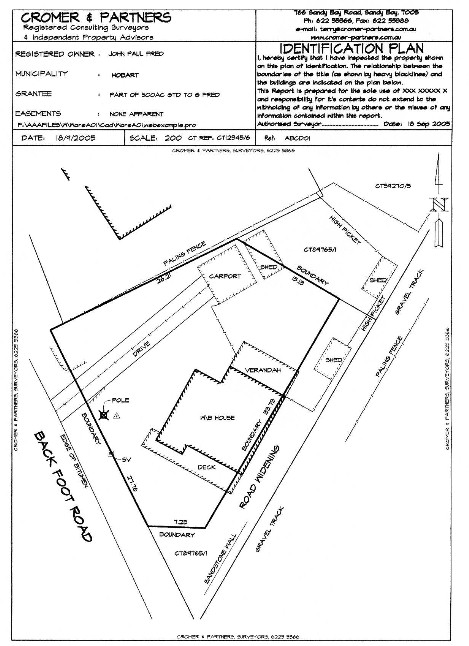
Identification Survey

An Identification Survey: confirms or otherwise that what you have seen on site is reflected in the title you purchase. It clarifies the relationship between the improvements (fences, buildings, sheds, driveways etc) at the location with the title boundaries. It does NOT redefine the boundaries of the site (ie the boundaries are not certified as correct for legal purposes), it gives a general relationship between the boundaries and the improvements. If instructing firstly have a look at those links relating to Survey Fees, Terms of Contract and Survey Methology.
It should be noted that if your instruction relates to a Strata Title, then formal Identification of Common Property boundaries will not occur unless specifically instructed to do so.
It does NOT result in boundary or corner pegs or survey marks being placed nor levels or contours being derived and should NOT be used as the basis of a building or structure setout. Survey Fees are applicable.
If your Title is a "Sketch By Way of Illustration" then an Identification Survey is a must!
A Remark Survey will place such marks and define the boundaries and is lodged at the Lands Titles Office for Registration with the Title documents.
The example to the right is extreme but is a real life case and does happen!!
Contact us for advice in relation to these matters.
