Please Write a Review if you feel this page has been of assistance.
Note: Should a Land Surveyor place a formal boundary mark at a title corner or along a title boundary that surveyor is required to lodge formal title boundary remak notes at the Land Titles Oiffce as a legal record of the survey. This protects the land owner should anyone question the location of future site fencing or improvements to the title.
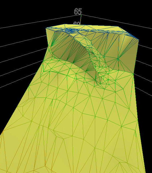
Engineering Surveys are carried out to provide both vertical and horizontal details over your land to facilitate the further engineering design of roads or servicing. If instructing firstly have a look at those links relating to Survey Fees, Terms of Contract and Survey Methology. A DTM (Digital Terrain Model) is usually the digital result of such a survey, making it possible for other associated consultants to process the field information. When viewing the example to the right, the image is an image of the digital information that is provided to other consultants. Note the digital depiction of the driveway running down the embankment.
HOW WE ASSIST:
We can co-ordinate with other allied professionals so that the survey is tailored to the precise requirements of your project.
Contact us for advice in relation to these matters.
